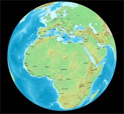
Add-on:Demis WorldMap
From World Wind Wiki
| Demis WorldMap | |
|---|---|
| Demis WorldMap
| |
| Developer | Bart Adriaanse |
| Latest release | 1.0 / 2005-08-31 |
| License | undefined |
| Web site | Demis |
WorldWind is an exciting new 3D visualisation tool developed by NASA.
Because the structure of WorldWind is very open and it supports OpenGIS WMS servers, it was quite easy to make WorldWind display maps coming from our server.
To greatly improve performance we have gone a step further by developing a WorldWind specific connector which caches the rendered images on the server.


