Image Overlay
From World Wind Wiki
| Image Overlay | |
|---|---|
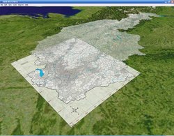
| Screenshot shows maps created by mazop
| |
| Developer | Bjorn Reppen aka "Mashi" |
| Latest release | 1.02 / 2005-06-21 |
| License | undefined |
| Web site | mashiharu.com |
Not compatible with World Wind 1.4
This plug-in is now included in World Wind
Allows loading images from file or URL and positioning them on the planet. Requires 2005-06-07 build of WorldWind. Included map created by mazop.
(Attention: This version does not work with WW 1.3.5, however the plugin now comes standard with the distribution)
Some hints for use from a user (authors apparently dont provide any support):
The file "overlay.txt" defines the images and coordinates: Each image is one line, values are separated by tabs, order is important:
<Name> <Path> <Point left-upper> <Pnt right-upper> <Pnt left-lower> <Pnt right-lower> <Pnt W1> <Pnt W2> <Opacity>
- Each Point is a latitude, longitude pair of values
- Opacity is an integer 1-255
- Points W1 and W2 are Wrap Points for distortion. For an image with constant lat/lon delta for each pixel (recommended anyway) the values shoud be:
W1 = Lat_max - Lat_min /2 , Lon_max- Lon_min / 2 (i.e center of image)
W2 = Lat_max - Lat_min /2 , Lon_max


